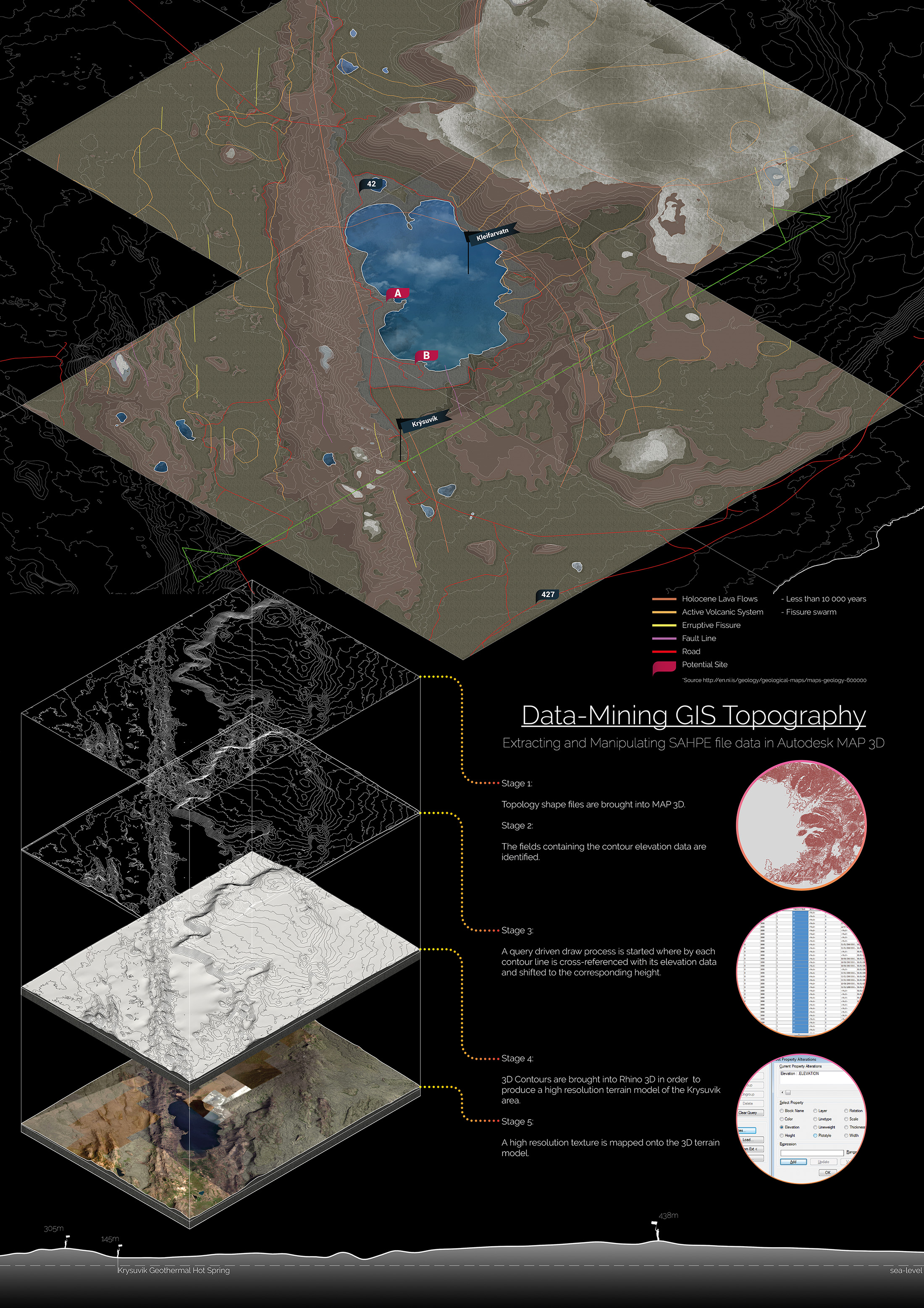
Stage 4
Processing
Data-mining Iceland
My masters kicked off with a unit trip to Iceland, in November 2016, this journey provided me a unique opportunity to experience the border of the Arctic Circle, a landscape unlike anything I’ve previously experienced, as well as the chance to see the northern lights. Unfortunately, the weather proved to bad for our group to get an opportunity to see this natural phenomenon. This promoted me to investigate the challenges associated with viewing the northern lights as a theme for my fourth year design project.
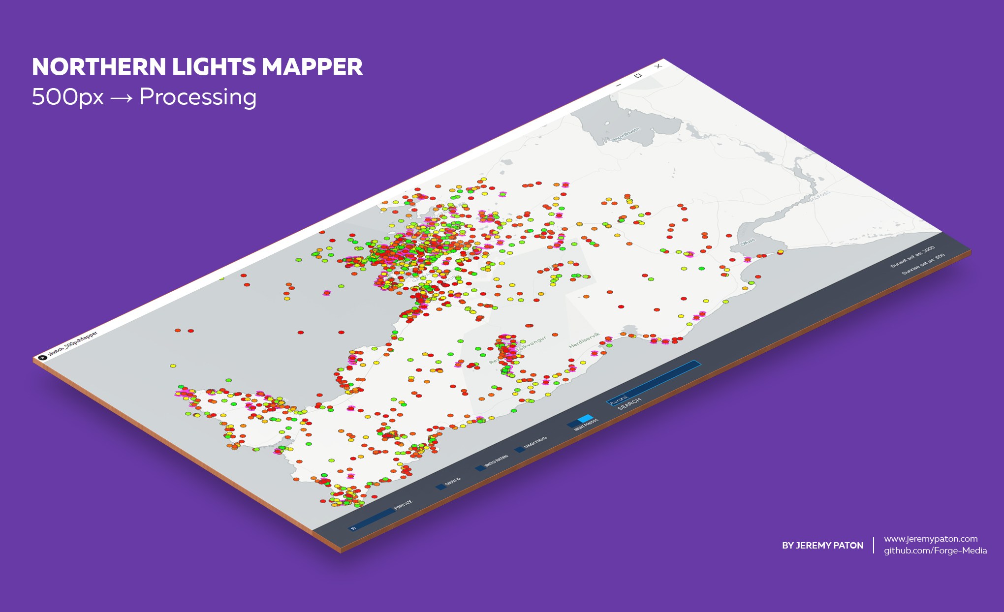
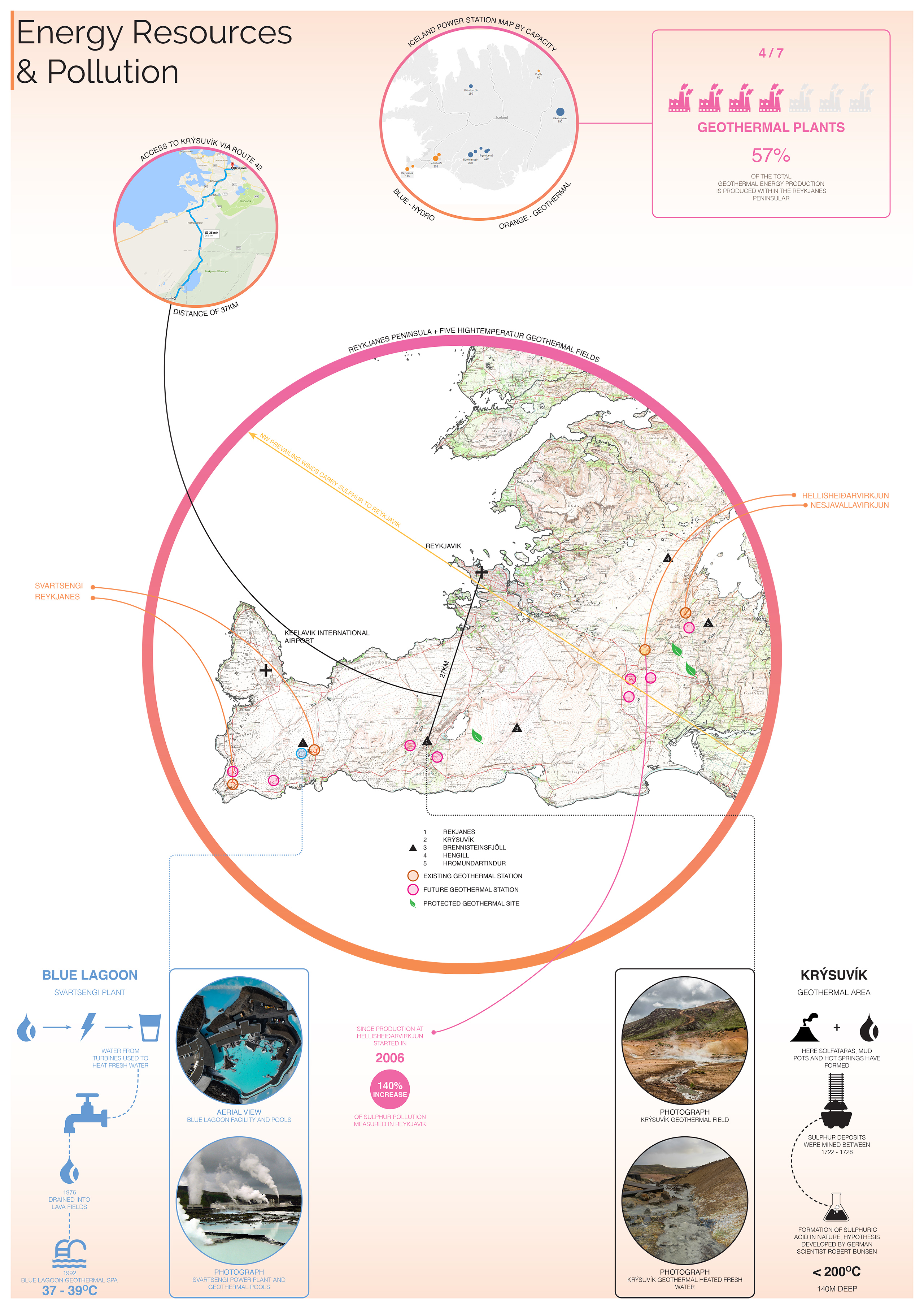
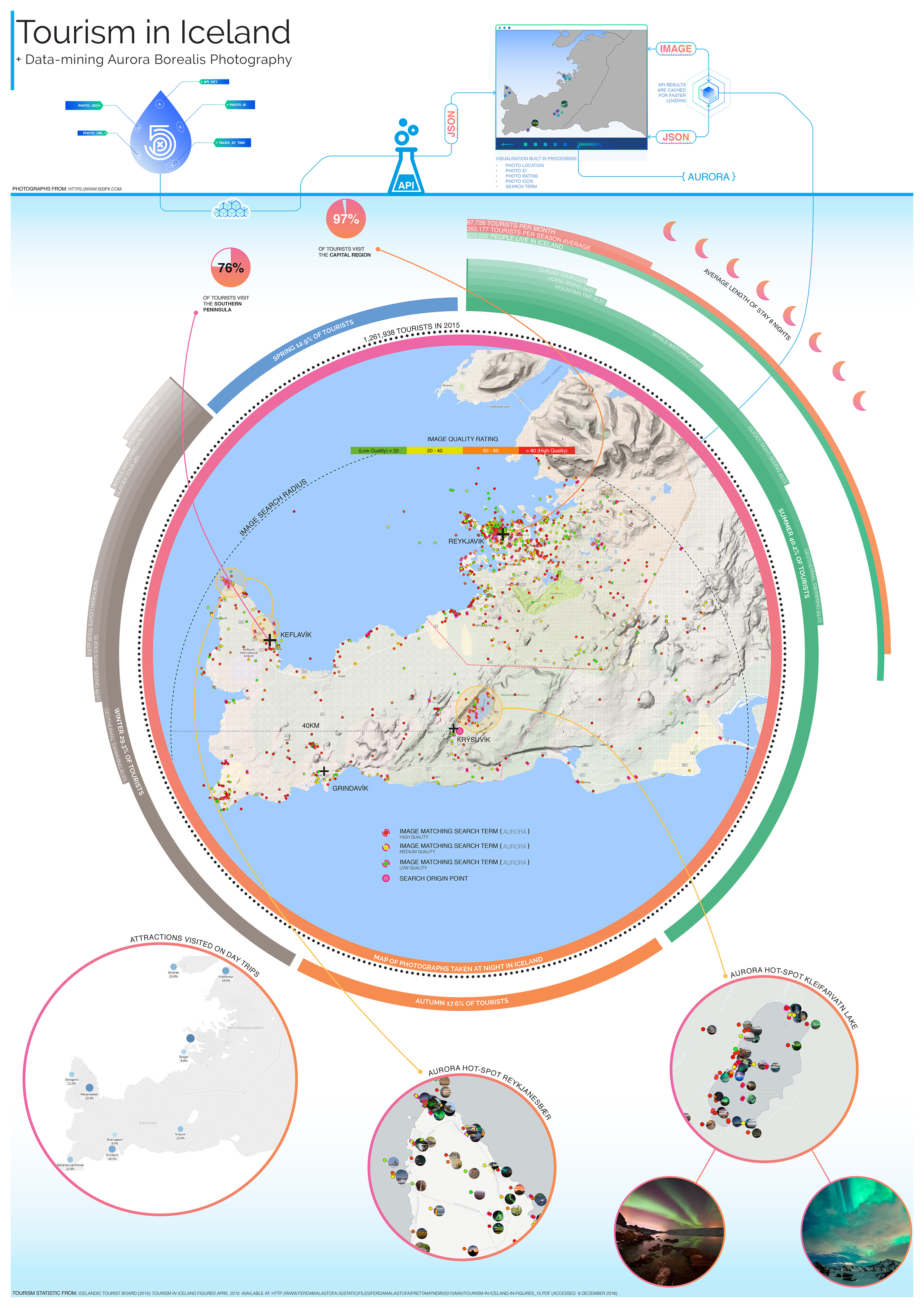
The key challenges when trying to view the lights, besides the weather, are usually the modes of travel and accommodation based on your location in Iceland. In order to identify Zones of Opportunity for photography I decided to extract mass-amounts of data from social media services such as Instagram and 500px. I settled on only using 500px due to it’s higher quality images, as it’s a market place for professional photographs, often includes EXIF data including geo-coordinates and at the time, provided an open REST-API, unlike Instagram.

Data access (APIs) & Software
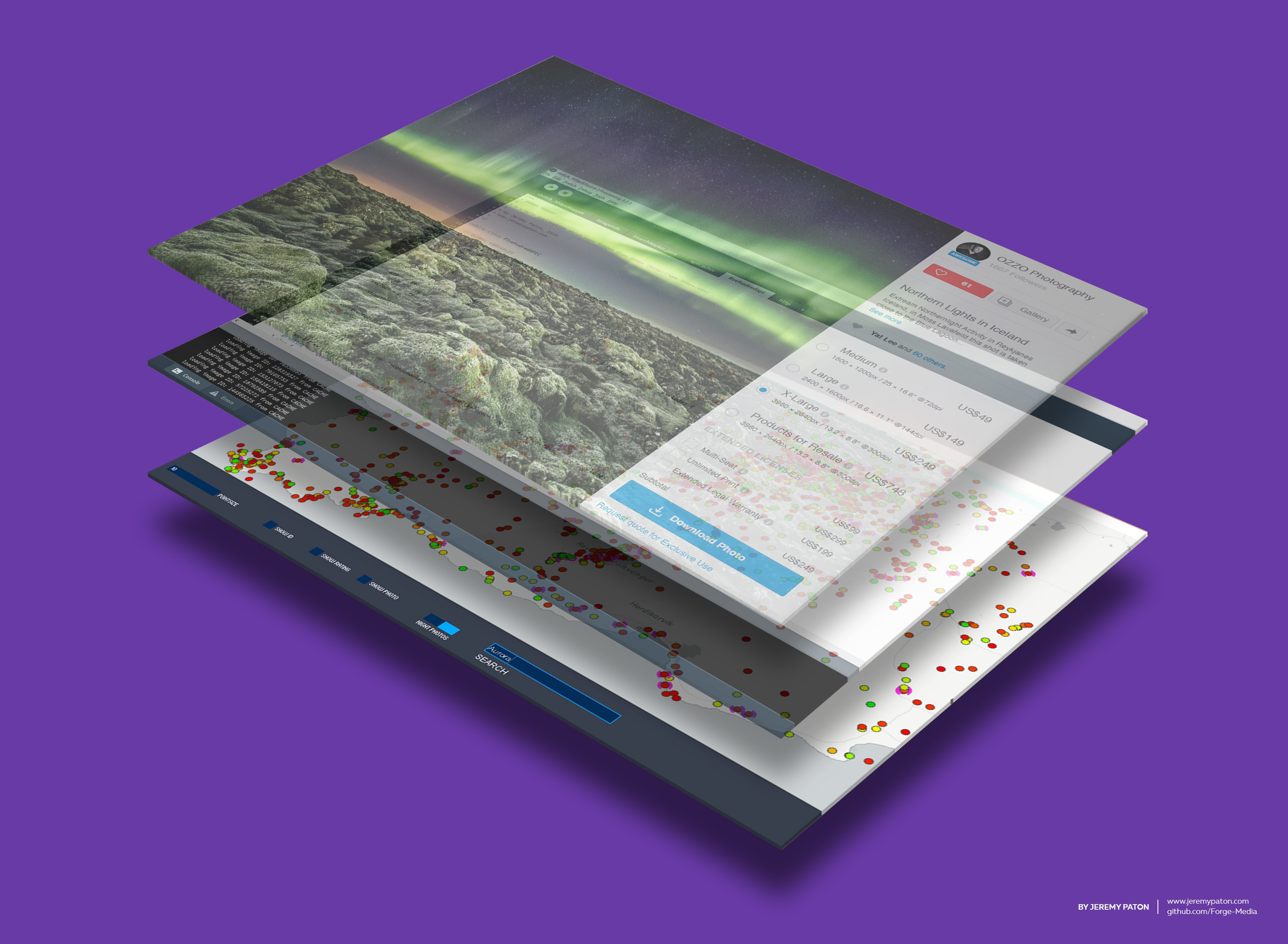
I used 500px’s API to cache thousands of images which matched a geo-coordinate within a defined radius in the Reykjanes Peninsula and time-stamps which matched periods within the night. I used the meta data, such as image title and description, to further refine the data and provide a search function for a term “aurora” and highlighted any photos which matched the criteria in purple.
By utilising these generated maps I was able to identify Zones of Opportunity around lake Kleifarvatn in the Krýsuvík geothermal region. These locations would become the future locations for my design project.
The full Processing Application can be downloaded from my GitHub repository, clicking the button bellow!
Get The Code
Icelandic Site Analysis
Icelandic Big Data Analysis
Krýsuvík Geothermal Region Analysis